All data here is produced under the Copernicus Programme and is provided free of charge, without restriction of use. For the full license information see the Copernicus Regulation.
Publications, models and data products that make use of these datasets must include proper acknowledgement, including citing datasets and the journal article as in the following citation.
Jean-Francois Pekel, Andrew Cottam, Noel Gorelick, Alan S. Belward, High-resolution mapping of global surface water and its long-term changes. Nature 540, 418-422 (2016). (doi:10.1038/nature20584)
If you are using the data as a layer in a published map, please include the following attribution text: 'Source: EC JRC/Google'
For a description of all of the datasets and details on how to use the data please see the Data Users Guide.
We have updated the Global Surface Water Explorer dataset to include recent years. Please note the following key details regarding this new release:
All of the datasets that comprise the Global Surface Water 1984-2021 and the recent 2022-2024 are being made freely available using the following delivery mechanisms: Global Surface Water Explorer, Data Download, Google Earth Engine and Web Map Services. These are described in the following sections.
The Global Surface Water Explorer is a simple web-mapping tool that shows all of the water datasets and allows users to navigate the globe visualizing the water datasets without installing any software. It also allows users to view the complete history of water detections over the 37-year period by clicking on the map. The tool is intended as a data viewer and does not provide any analytical features - if you would like to do your own analysis on the data then access the data using Data Download or Google Earth Engine. Explore the map.
Currently all of the mapped datasets are available to download (i.e. occurrence, change, seasonality, recurrence, transitions and maximum extent).
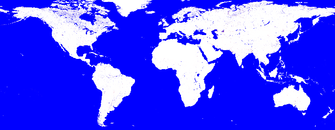
The Global Surface Water data are available to download in tiles 10°x10° from the map shown below. Click on the tile to show a list of the available datasets. Each one of these datasets is a hyperlink to the *.tif file.
The full global surface water datasets can be downloaded by using this Python 2 script or using this Python 3 script . The zip file contains the Python script and a set of instructions for using it. An handy alternative way to download this data is to use the following script wrote by Petr Tsymbarovich, available at this GitHub link.
It is possible to download all the Global Surface Water Datasets up to 2021 via FTP using the Filezilla Client . Once downloaded and installed Filezilla, write in the Host field the link jeodpp.jrc.ec.europa.eu and then browse to GSWE folder to get all the Global Surface Water Explorer data. Alternatively, it is possible to get the data using the link https://jeodpp.jrc.ec.europa.eu/ftp/jrc-opendata/GSWE/
Each of the downloadable files contains a colormap which will display the files in desktop GIS tools (such as QGIS or ArcGIS) using the symbology that has been used in the Global Surface Water Explorer. However, these colormaps do not contain the labels for the values. These can be added to the files by using the following symbology files. For instructions on how to use these files see the 'Using Symbology Files' section of the Data Users Guide.
| Dataset | QGIS | ArcGIS |
|---|---|---|
| Occurrence | occurrence.qml | occurrence.tif.lyr |
| Occurrence change intensity | change_0_200.qml change_-100_100.qml | change.tif.lyr |
| Seasonality | seasonality.qml | seasonality.tif.lyr |
| Recurrence | recurrence.qml | recurrence.tif.lyr |
| Transitions | transitions.qml | transitions.tif.lyr |
| Maximum water extent | extent.qml | extent.tif.lyr |
There are also symbology files where the above palettes are unsuitable for users with deuteranopia colour-blindness:
| Dataset | QGIS | ArcGIS |
|---|---|---|
| Occurrence change intensity | change_deuteranopia.qml change_-100_100_deuteranopia.qml | change_deuteranopia.tif.lyr |
| Transitions | transitions_deuteranopia.qml | transitions_deuteranopia.tif.lyr |
There are no symbology files for the monthly or the yearly water history as files are encoded and must be decoded before they can be mapped.
The downloadable files do not contain any metadata information and so it is provided here for each of the datasets. You may need to right click and Download Linked file.
| Dataset | ISO 19139 Metadata file |
|---|---|
| Occurrence | occurrence.xml |
| Occurrence change intensity | change.xml |
| Seasonality | seasonality.xml |
| Recurrence | recurrence.xml |
| Transitions | transitions.xml |
| Maximum water extent | extent.xml |
The 2021 data are available in the Google Earth Engine data catalog
Tutorials for using the Global Surface Water Dataset in Google Earth Engine are available here.
The data can also be accessed and used in the Google Earth Engine platform - for more information see here. The 1984-2015 asset (green) is the version of record of the 2016 Nature publication (Pekel et al., 2016). : the exact validated dataset on which the published analysis is based. It is retained unchanged so that the published results remain reproducible. The subsequent updates (yellow) extend the record beyond 2015. They were produced with equivalent care but were not subjected to the validation applied to the original dataset. They may therefore contain artefacts, in particular co-registration differences introduced by the change in ground control between Landsat Collection 1 and Collection 2. The following asset ids are used in Google Earth Engine:
| Dataset | Asset ID 1984-2015 | Asset ID 1984-2018 | Asset ID 1984-2019 | Asset ID 1984-2020 | Asset ID 1984-2021 |
|---|---|---|---|---|---|
| Map layers | JRC/GSW1_0/GlobalSurfaceWater | JRC/GSW1_1/GlobalSurfaceWater | JRC/GSW1_2/GlobalSurfaceWater | JRC/GSW1_3/GlobalSurfaceWater | JRC/GSW1_4/GlobalSurfaceWater |
| Yearly Seasonality | JRC/GSW1_0/YearlyHistory | JRC/GSW1_1/YearlyHistory | JRC/GSW1_2/YearlyHistory | JRC/GSW1_3/YearlyHistory | JRC/GSW1_4/YearlyHistory |
| Monthly History | JRC/GSW1_0/MonthlyHistory | JRC/GSW1_1/MonthlyHistory | JRC/GSW1_2/MonthlyHistory | JRC/GSW1_3/MonthlyHistory | JRC/GSW1_4/MonthlyHistory |
| Monthly Recurrence | JRC/GSW1_0/MonthlyRecurrence | JRC/GSW1_1/MonthlyRecurrence | JRC/GSW1_2/MonthlyRecurrence | JRC/GSW1_3/MonthlyRecurrence | JRC/GSW1_4/MonthlyRecurrence |
| Metadata | JRC/GSW1_0/Metadata | JRC/GSW1_1/Metadata | JRC/GSW1_2/Metadata | JRC/GSW1_3/Metadata | JRC/GSW1_4/Metadata |
The new 2024 data are available as Google Earth Engine assets We have entirely recomputed the Seasonality layers from 2016 to 2021 (still based on Landsat Collection 1) to correct a known issue that occasionally overestimated seasonal surface water.
| Dataset | New Asset ID 2016-2021 |
|---|---|
| Map layers | projects/global-surface-water/assets/GSW1_5/Seasonality_2016_2021 |
New assets are available for the extended period 2022-2024 derived from Landsat Collection 2 (Landsat 8-9): Aggregated products (e.g. Occurrence, Recurrence, Transitions etc.) cover the entire period 1984-2024 merging the two Landsat collections.
| Dataset | New Asset ID 2022-2024 |
|---|---|
| Map layers | projects/global-surface-water/assets/GSW1_5/Occurrence projects/global-surface-water/assets/GSW1_5/Recurrence projects/global-surface-water/assets/GSW1_5/Transitions projects/global-surface-water/assets/GSW1_5/Change projects/global-surface-water/assets/GSW1_5/Seasonality_2022_2024 projects/global-surface-water/assets/GSW1_5/MaxWaterExtent_2022_2024 |
| Yearly Seasonality | projects/global-surface-water/assets/GSW1_5/YearlyHistory |
| Monthly History | projects/JRC/GSW1_5/MonthlyHistory_2022_2024 |
| Monthly Recurrence | projects/JRC/GSW1_5/MonthlyRecurrenceMetadata |
| Metadata | projects/JRC/GSW1_5/Metadata * |
* : soon available
Hereafter and example of how to merge the YearlyHistory v1.4 and 1.5 to obtain a single collection containing data from 1984 to 2024: var YearlyHistory84_24 = ee.ImageCollection('JRC/GSW1_4/YearlyHistory').merge(ee.ImageCollection('projects/global-surface-water/assets/GSW1_5/YearlyHistory').map(function(image) {return image.select([0], ['waterClass'])}));
The Global Surface Water data can also be used within other websites or GIS clients by using what are called 'Web Map Services'. These services provide a direct link to the cached images that are used in the Global Surface Water Explorer and are the best option if you simply want to map the data and produce cartographic products. They are not suitable for analysis as the data are represented only as RGB images.
The Web Map Services can also be used within websites using any Javascript Mapping API that supports tiled layer types. The examples below show you how to create and add the transitions layer in Leaflet v1.0 and then ArcGIS Javascript API v3.18. The layer type can be one of: transitions, occurrence, change, seasonality, recurrence or extent.
Web Map Services for version 1.4 referring to year 2021 are accessible at the following link by replacing the placehoder __LAYER__ with the desired layer type - https://storage.googleapis.com/global-surface-water/tiles2021/__LAYER__/{z}/{x}/{y}.png
Leaflet:
    var transitions = new L.tileLayer(https://storage.googleapis.com/water-world/tiles2024/transitions/{z}/{x}/{y}.png",
    { format: "image/png",
      maxZoom: 13,
      errorTileUrl : "https://storage.googleapis.com/global-surface-water/downloads_ancillary/blank.png",
      attribution: "2016 EC JRC/Google" });
    map.addLayer(transitions);
ArcGIS Javascript API:
    var transitions = new WebTiledLayer("https://storage.googleapis.com/water-world/tiles2024/transitions/{level}/{col}/{row}.png",
    { "copyright" : '2016 EC JRC/Google' });
    map.addLayer(transitions);
The Web Map Services for the year 2020 are available in the ESRI ArcGIS Online platform as a set of WMTS layers. To see a list of the datasets, search for 'GSW'.
If you have any feedback on the Global Surface Water data please contact: jrc-surfacewater@ec.europa.eu