A virtual time machine that maps the location and temporal distribution of water surfaces at the global scale over the past 3.8 decades, and provides statistics on their extent and change to support better informed water-management decision-making.

Start exploring!

Find out all about the Global Surface Water!

You can read the full article, or download our dataset!

Stop waiting. Start exploring.

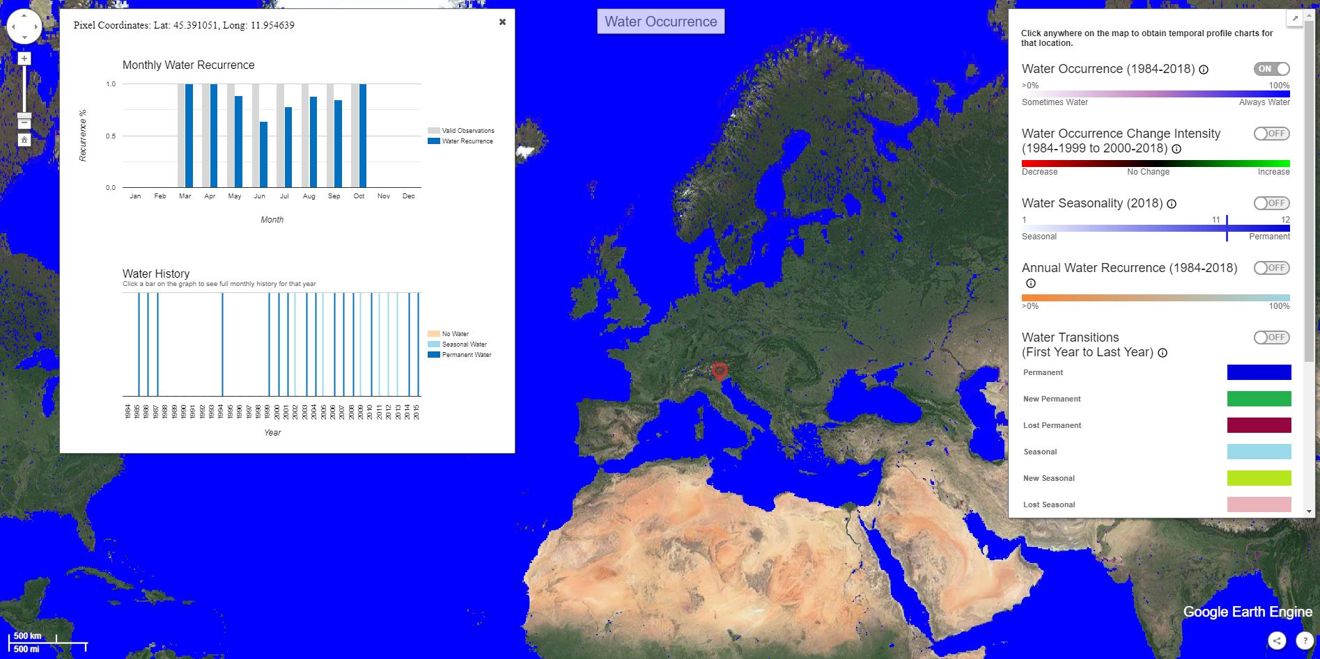
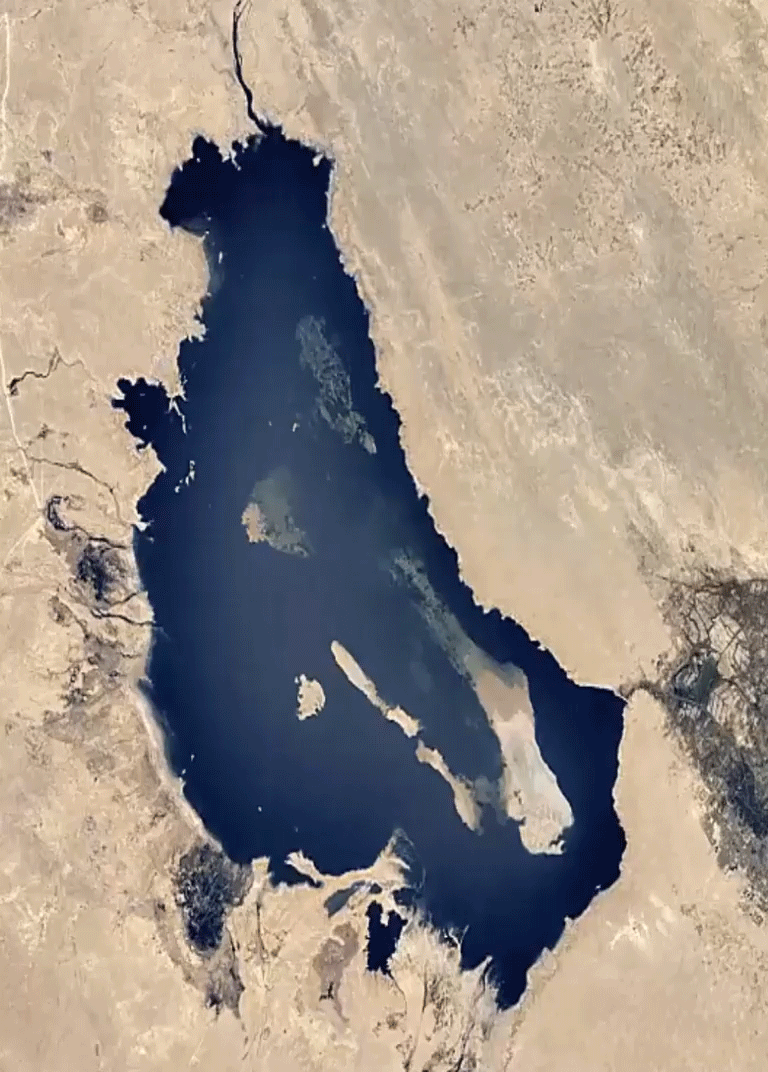
The European Commission's Joint Research Centre developed this water dataset in the framework of the Copernicus Programme. This maps the location and temporal distribution of water surfaces at the global scale over the past 3.8 decades and provides statistics on the extent and change of those water surfaces. The dataset, produced from Landsat imagery, will support applications including water resource management, climate modelling, biodiversity conservation and food security.


Explore

Our data are
free and open

Get them!

We need to go back in time to accurately measure changes in surface water

Disappearing Aral Sea

Lake expansion in the Tibetan Plateau

New dam (Sudan)

Disappearing lake (Lake Milh-Iraq)

Measuring the past helps to understand the consequences of our past economic and societal choices, and contributes to more informed management decisions.

GSWE for SDG 6.6.1 sdg logosdg logo

The European Commission's Joint Research Centre, UN Environment and Google are partnering to provide free and open data on water extent in a way that is policy-friendly, so that citizens and governments can easily assess what is actually happening to the world's natural resources, starting with data on water extent as a priority environmental issue. For this purpose, a dedicated interface built on the top of the GSWE was jointly developed by the European Commission’s Joint Research Centre, UN Environment and Google

SDG 6.6.1


Contact us!

jrc-surfacewater@ec.europa.eu